Joined: 16 Dec 2007 Location: Modding other games.
Posted: Thu Dec 02, 2010 1:18 am Post subject:
Satellite imaging practice
Subject description: Photoshop Cartography vs Satellite imaging >_>
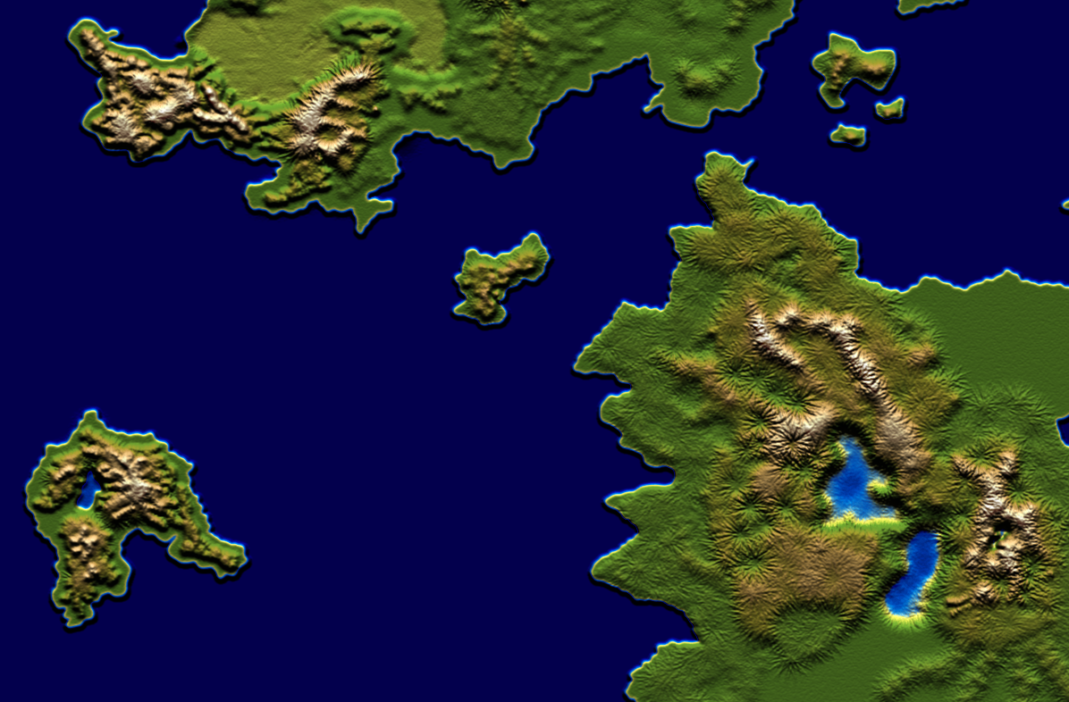
I recently started on some Satellite style map images for an upcomming TC mod project with Aro. But I'm not really confident about hows results going so I decided to ask for some critique and advices from those who have experience in this cartography stuff in photoshop. Mainly advices on making more natural looking mountains fractals and hills, etc.
I started over many times testing gradient color height maps, but this looks fine for me so far. Oh and don't mind the ocean detail. I only intend to work on landmass for now.
fractals.PNG
Description:
Filesize:
937.91 KB
Viewed:
3424 Time(s)
_________________
Quote:
Everybody knows a mod that doesn't update every ten seconds is dead.
Joined: 18 Feb 2005 Location: Star Kingdom of Manticore
Posted: Thu Dec 02, 2010 7:18 am Post subject:
REALLY good, but it lacks rivers and their corresponding terrain. _________________ "Reality is a lovely place, but I wouldn't want to live there." -Adam Young QUICK_EDIT
I think the small star shaped lines/hills going away from the big mountains look too artificial.
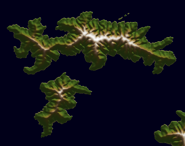
Maybe this picture helps you to give it a more realistic look.
Imo the best mountain area is the one on the small island in the southwest on the last picture. There the star shaped lines aren't that much present and also alternated with some alluvial hills which aren't looking they are made out of pure rocks. I also like the small, slightly brighter lake that fits well into this area. _________________ SHP Artist of Twisted Insurrection: Nod buildings
Joined: 16 Dec 2007 Location: Modding other games.
Posted: Thu Dec 02, 2010 6:10 pm Post subject:
Lin Kuei Ominae wrote:
I think the small star shaped lines/hills going away from the big mountains look too artificial.
Maybe this picture helps you to give it a more realistic look.
Imo the best mountain area is the one on the small island in the southwest on the last picture. There the star shaped lines aren't that much present and also alternated with some alluvial hills which aren't looking they are made out of pure rocks. I also like the small, slightly brighter lake that fits well into this area.
Ah just what I needed . I do agree that the SW islands geography look more natural from the rest. I mostly did the large continents by abusing the use of a larger brush size to save time. Thanks LKO, for your critique. I'll try improve on that, but I somewhat find it nearly impossible to emulate such natural looking mountain fractals by hand.
@Everyone else: Thanks but river planning comes next after I'm done with the map's general landmass. This is my first large scale attempt on making a satellite map. _________________
Quote:
Everybody knows a mod that doesn't update every ten seconds is dead.
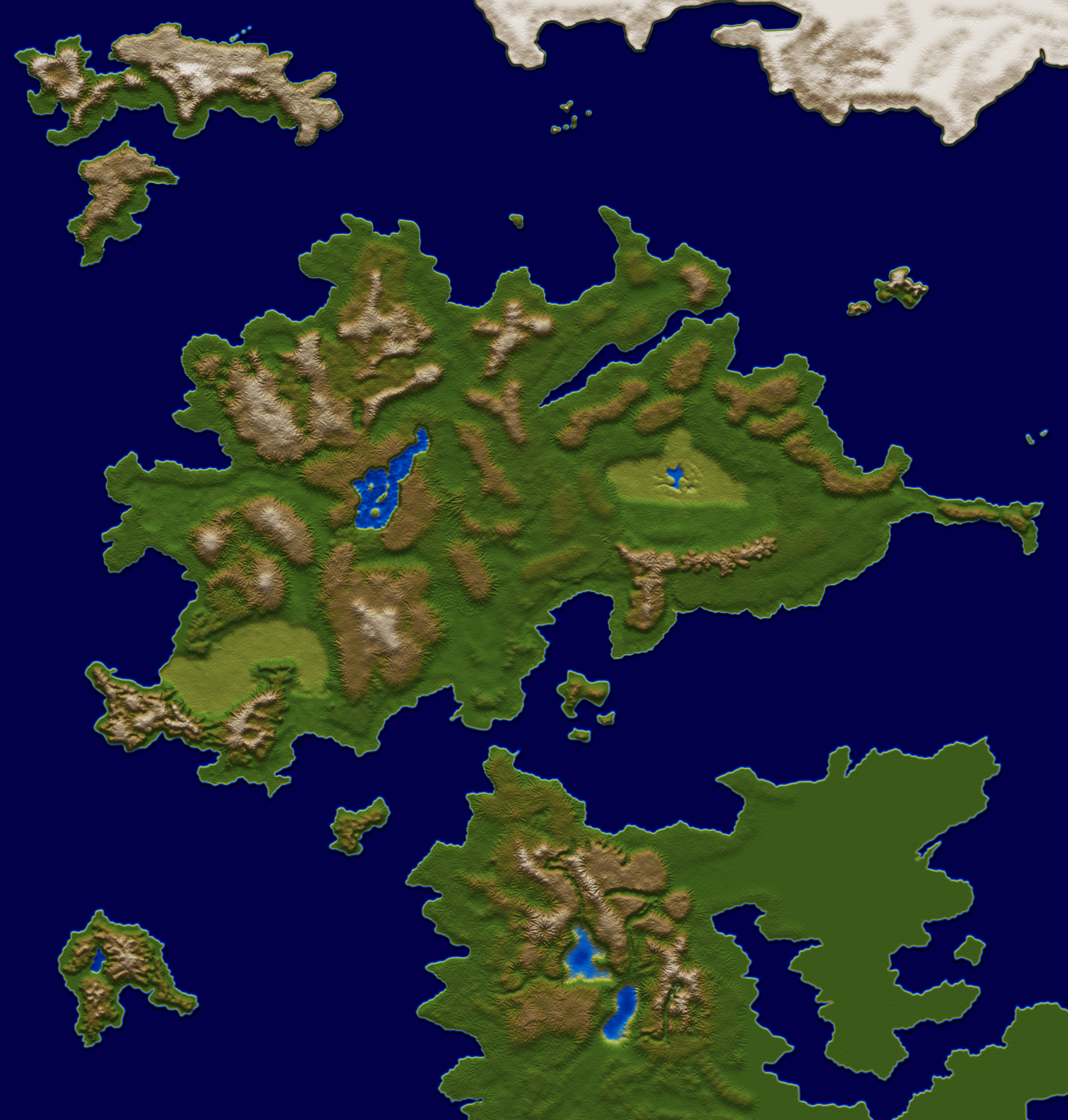
Well, there are a couple of stuff to correct:
1. Water should have as well relief.
2. The relief "effect" you use is kinda repetitive. Try making some patterns using...erm, Google is your friend.
3. There isn't enough darkness/brightness effects, it all looks like its plastic.
4. The lakes look a bit odd. QUICK_EDIT
I'm not sure if it's possible, but do you've thought about using Terragen?
Most generated landscape pictures are made from a ground based camera view, but maybe you can set the camera to satellite view and this way let Terragen generate random environment pieces. Then you could try to merge different generated areas (mountains, valleys, rivers, lakes etc) into your final big satellite image. _________________ SHP Artist of Twisted Insurrection: Nod buildings
Joined: 16 Dec 2007 Location: Modding other games.
Posted: Fri Mar 18, 2011 9:31 pm Post subject:
Well, its been a while since I last updated this. LKO, I got similar results with mountain ridges using Incise Flow Erosional effects using Wilbur instead of Terragen. I haven't generated a river layer yet since I'm focusing mainly towards landscape.
I haven't added precipitation erosion effects yet but I'm liking whats coming out so far. I'll update more later with pictures of other continents.
test.png
Description:
mountain ridges came out good so far but it feels somewhat too smooth and needs more variations. then again, I don't want to add too much detail.
Filesize:
147.15 KB
Viewed:
2799 Time(s)
_________________
Quote:
Everybody knows a mod that doesn't update every ten seconds is dead.
Joined: 24 Sep 2009 Location: Originally from Philipines. Currently on NZ. Hacker Type: Game Hacker
Posted: Sat Mar 19, 2011 2:37 am Post subject:
The land looks bright, and the oceans do not match because it only has one color. Maybe adding a little depth to it and some islands. _________________ Learning C++ QUICK_EDIT
Relief maps shouldn't show desert or savannahs or anything. Color is relative to height of terrain, which, I believe this is a relief map, no? _________________ Victory! QUICK_EDIT
The thing I found easiest in this kind of cartography was painting it all up manually in greyscale and then mapping it to a suitably created colour gradient. Black being very high up and white being very far down. QUICK_EDIT
You cannot post new topics in this forum You cannot reply to topics in this forum You cannot edit your posts in this forum You cannot delete your posts in this forum You cannot vote in polls in this forum You cannot attach files in this forum You can download files in this forum